Guides · Nature
São Miguel island guide: crater lakes, hot springs and tea
The Azores' biggest island packs crater lakes, thermal pools, tea fields and the region's main city into a short drive. Here is how to plan it.
4 min read
Updated 18 October 2026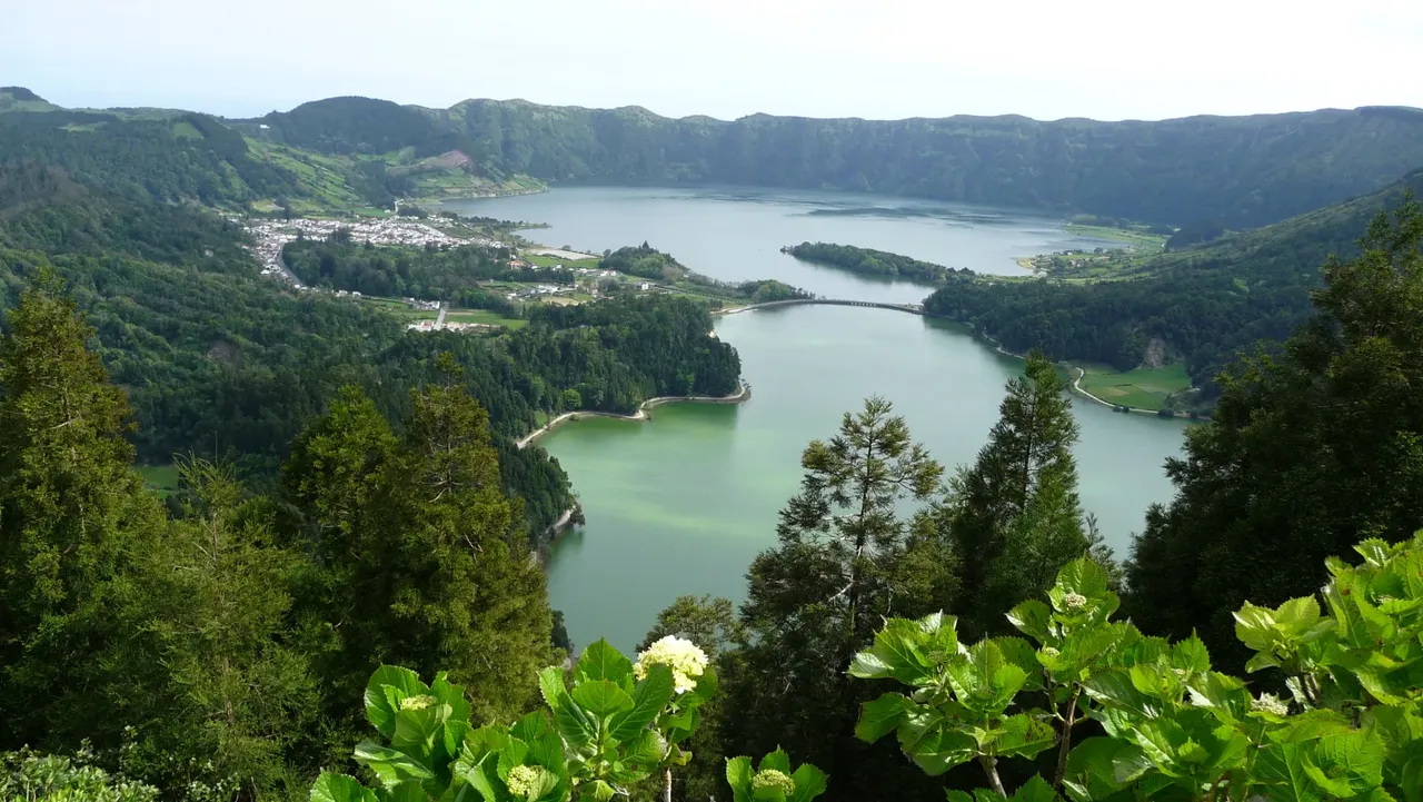
São Miguel is the largest island in the Azores and home to more than half of its people, as well as the seat of the regional government. It is also the island most visitors see first, and for good reason: it has the best connections, the widest range of services and an astonishing amount of volcanic scenery within an hour or two of Ponta Delgada. Visit Azores calls it the Green Island, and after a day among its pastures and cedar woods you will understand why.
What makes São Miguel different
The island is built from two mountain areas joined by a lower central platform, with Pico da Vara (1,105 m) as its highest point. What sets it apart is the sheer variety packed into a small space: lakes sitting in craters several kilometres wide, valleys full of hot springs and fumaroles, black-sand beaches, and tea plantations, a rarity in Europe, at Gorreana and Porto Formoso, where you can visit the factories and taste the tea.
Places not to miss
- Sete Cidades: the classic view is from the Vista do Rei lookout, where the green and blue lakes sit side by side, joined by a bridge.
- Lagoa do Fogo: a wilder crater lake in the middle of the island, protected as a Nature Reserve.
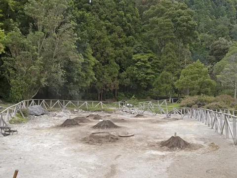
- Furnas: a valley of thermal springs and steaming ground, with the iron-rich warm pool of Terra Nostra Park and the famous cozido, a stew slow-cooked in pots buried in the hot soil.
- Hot water elsewhere: Caldeira Velha, Poça da Beija, the Caldeiras of Ribeira Grande and Ponta da Ferraria, where volcanic springs warm the sea itself.
- The east: the gardens and lookouts of Nordeste, and the Lomba do Cavaleiro viewpoint over the caldera of Povoação.
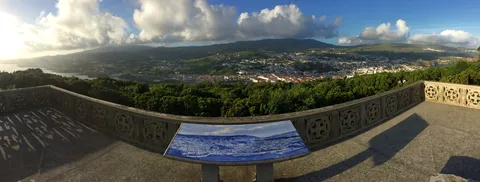
- Ponta Delgada: the three arches of the Portas da Cidade, the old churches and the Carlos Machado Museum in the former Convent of Santo André.
- Coast and caves: the islet off Vila Franca do Campo, the Mosteiros coast at sunset and the Gruta do Carvão lava cave.
Getting there and getting around
With the widest range of facilities in the Azores, São Miguel works well as the gateway to the rest of the archipelago; see our guides to inter-island flights and ferries for how the islands link up. Santa Maria, the other island of the Eastern Group, lies about 81 km away. On the island itself, a car gives you the most freedom, since many lookouts and trailheads are in the hills well away from the towns.
How many days you need
Four days is a comfortable minimum. Give one day to the west (Sete Cidades, Mosteiros, Ferraria), one to the centre (Lagoa do Fogo, Caldeira Velha, Ribeira Grande and the tea fields), one to Furnas and one to Povoação and Nordeste. A fifth day lets you slow down in Ponta Delgada or head out to sea. Our São Miguel in four days itinerary sets this out stop by stop.
Nature, safety and when to go
The only certified trail to the shore of Lagoa do Fogo is the PR02SMI walking trail, which starts near the Parque Escutista dos Lagos. Expect wet, muddy stretches along the water channel, keep to the marked path and give the nesting gulls space in April and May. In summer the regional government has run a shuttle to the Lagoa do Fogo viewpoints to ease traffic, so check the current arrangements before you drive up. Before any walk, look at the trail's status on Trails Azores.
São Miguel is green all year, but its festivals are a good reason to time a visit: the Senhor Santo Cristo dos Milagres festival fills Ponta Delgada around the fifth Sunday after Easter, the Holy Ghost festivals run from May to September, and the Cavalhadas de São Pedro ride through Ribeira Seca on 29 June.
Weather on the crater rims can change within hours. If Sete Cidades or Lagoa do Fogo is under cloud, spend the morning on the coast and go back up later.
- Topic
- Nature
- Islands
- São Miguel
- Reading time
- 4 min