Trails · Hard
Baleeiros
A long coastal trek through Faial's whaling history, from Cedros to the natural pools of Varadouro.

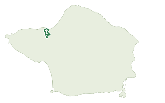
The route starts near the parish church of Cedros and follows old rural paths along the coast, past the active whale-watching lookouts of Cabeço da Vigia and Alto das Concheiras and the ruined ones at the old Cedros port and Costado da Nau. It takes in the viewpoints of Ribeira Funda, within a picnic area, and Ribeira das Cabras, with views over the lava flats of Praia do Norte and the Capelo Peninsula.
Near the Fajã, the black basalt of the shore shows green olivine xenoliths thrown up by the 1672 eruption of Cabeço do Fogo, and the final stretch passes remnants of laurissilva forest before crossing the lunar landscape of the Capelinhos Volcano geosite. There you can stop at the Interpretation Centre or the Casa dos Botes whaling exhibit before reaching Varadouro, the former whaling station turned natural swimming pools where the trail ends.
This is a long day out at 26 km with roughly 1,000 m of climb and a similar amount of descent; the operator gives no fixed time for it, so pace yourself generously and carry supplies for the whole route.
Elevation · from the official GPX
Up and down the trail
Plan your walk · MET Norway & IPMA
When to go
Pick a start time. We forecast where you'll be each hour — 3 m at the lowest point, 350 m at the top.
Official facts, our words
What to know
Trail facts
Difficulty Hard- Length
- 26 km
- Elevation gain
- 1,001 m
- Route
- Linear
- Highest point
- 350 m
- Steepest descent
- 37% at km 11.4
- Start
- Cedros parish church
- Finish
- Varadouro
- Permit
- Not required
- Trail code
- PR10FAI
Route and facts © Azores trails network (visitazores.com)