Trails · Moderate
Rocha da Fajã
A loop down a fossil cliff to the surf beach and historic village of Praia do Norte.
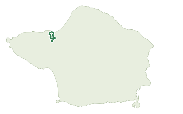
From the trailhead near the regional road, the path passes several fountains before dropping on a dirt track through cultivated fields to a cliff formed by the historic 1672 eruption of Cabeço do Fogo. The descent runs through laurel-forest heather and white wood, with a viewpoint over the north coast partway down.
At the base, the trail crosses the Adão stream and follows Rua das Adegas to Praia do Norte beach, a local surf spot, then continues along the coast past a play area, a native-plant reserve and a picnic area into the village centre, where the Chapel of Nossa Senhora da Penha de França dates to 1787. A dirt road climbs back up the cliff to close the loop near the start.
At 5 km with about 290 m of climb, this is a moderate outing of around two and a half hours.
Elevation · from the official GPX
Up and down the trail
Plan your walk · MET Norway & IPMA
When to go
Pick a start time. We forecast where you'll be each hour — 3 m at the lowest point, 256 m at the top.
Official facts, our words
What to know
Trail facts
Difficulty Moderate- Length
- 5 km
- Duration
- 2 hr 30 min
- Elevation gain
- 287 m
- Route
- Circular
- Highest point
- 256 m
- Steepest descent
- 37% at km 1.3
- Start
- Regional road near Praia do Norte
- Finish
- Regional road near Praia do Norte
- Permit
- Not required
- Trail code
- PRC02FAI
Route and facts © Azores trails network (visitazores.com)