Trails · Easy
Lagoa das Furnas
An easy circuit around Lagoa das Furnas, past thermal pools, a Gothic chapel, Europe's largest Norfolk pine and the geothermal Caldeiras area.
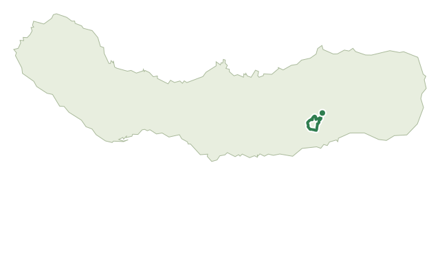
This easy circular trail starts at the parking area by the entrance to Furnas, near Largo das Três Bicas, and leads through the village past the Church of Santana and the thermal pool of Poça da Dona Beija to a crossroad continuing up to Pico do Milho, a viewpoint over the Furnas valley.
The route then drops to Lagoa das Furnas and follows a cobblestone road around the lake, passing the 19th-century Gothic Chapel of Nossa Senhora das Vitórias, the Mata Jardim José do Canto garden and the rural tourism house Casa dos Barcos. Further on, it reaches the Furnas Environmental Interpretation Centre and a leisure area with the ruins of old coal ovens and Europe's largest classified Norfolk Island pine.
Along the lake bank, a flat, accessible dirt road passes several wooden sculptures before reaching the Caldeiras area, known for its geothermal activity and the traditional Cozido das Furnas, cooked using the volcano's heat. The trail passes the viewpoint of Pico do Ferro and the ticket booth area before returning to the regional road and the village centre; at about 9.4 km and 3 hours, with around 210 m of climbing, this is an easy, mostly flat day out.
Elevation · from the official GPX
Up and down the trail
Plan your walk · MET Norway & IPMA
When to go
Pick a start time. We forecast where you'll be each hour — 204 m at the lowest point, 333 m at the top.
Official facts, our words
What to know
Trail facts
Difficulty Easy- Length
- 9.4 km
- Duration
- 3 hr
- Elevation gain
- 208 m
- Route
- Circular
- Highest point
- 333 m
- Steepest descent
- 26% at km 8.4
- Start
- Largo das Três Bicas, Furnas
- Finish
- Furnas
- Permit
- Not required
- Trail code
- PRC06SMI
Route and facts © Azores trails network (visitazores.com)