Trails · Moderate
Matas da Agualva
A loop through old mill country and working forest above Agualva, tracing the streams and sawmills that shaped the parish.
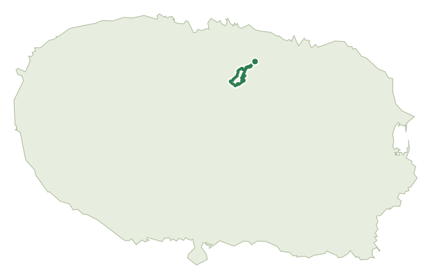
This loop starts and ends at the mill on Rua do Saco, in Agualva, and tells the story of the parish's two great resources: the streams that once powered nearly fifty watermills and still supply water to six of the municipality's eleven parishes, and the forests that still feed local sawmills and carpentry workshops.
The first stretch follows the riverbank past terraced orchards and the remains of old mills, waterwheels and irrigation channels, along with natural waterfalls and the leisure area of Parque das Frechas and its garden of endemic species. Further upstream the route crosses several watercourses and forest paths lined mostly with exotic species such as Australian cheesewood, eucalyptus, pine and tree ferns, passing the Varanda Sobre a Agualva viewpoint with its wide view over the parish and the Ramo Grande area, before the final stretch follows the old logging track of Atalho Alto, past old goat shelters and drainage channels linked to the Ribeira da Silveira springs and traces of the old water supply system that once ran to Air Base No. 4.
It's a medium route of about 7.7 km, crossing several watercourses along the way.
Elevation · from the official GPX
Up and down the trail
Plan your walk · MET Norway & IPMA
When to go
Pick a start time. We forecast where you'll be each hour — 223 m at the lowest point, 474 m at the top.
Official facts, our words
What to know
Trail facts
Difficulty Moderate- Length
- 7.7 km
- Elevation gain
- 287 m
- Route
- Circular
- Highest point
- 474 m
- Steepest descent
- 20% at km 4.6
- Start
- Rua do Saco
- Finish
- Rua do Saco
- Permit
- Not required
- Trail code
- PRC14TER
Route and facts © Azores trails network (visitazores.com)