Trails · Hard
Miradouro das Lagoas - Poço do Bacalhau
A short, steep drop from Flores' deepest lake to a 100 m waterfall above Fajã Grande.
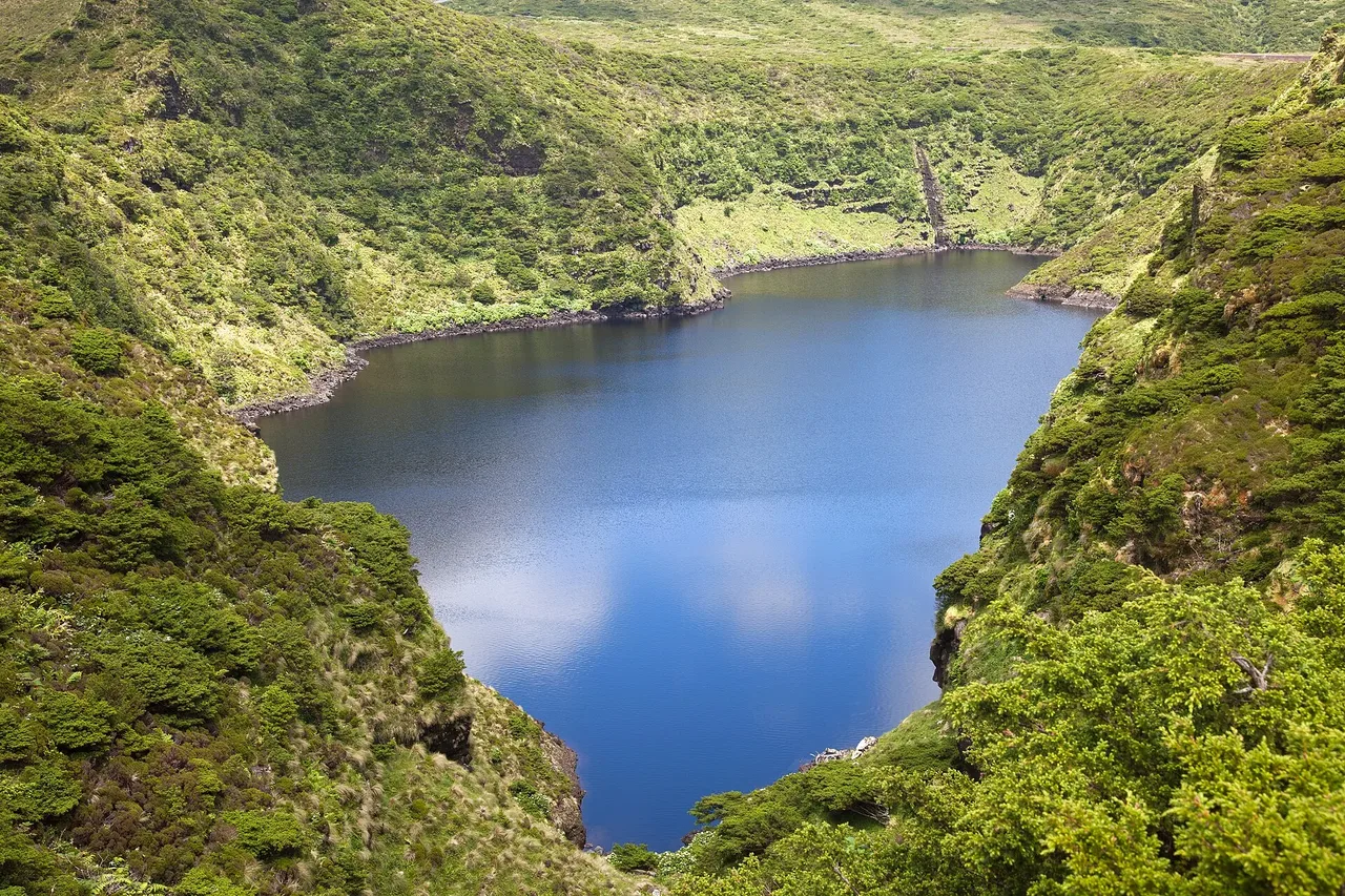
The trail starts on the central plateau at Lagoa Negra, at 108 m the deepest lake in the Azores, one of several maar lakes formed when rising magma met groundwater and triggered explosive eruptions, now known locally as caldeiras. From there the route runs west past the other crater lakes - Comprida, Seca and Branca - through the Natural Reserves of Morro Alto and Pico da Sé and the protected landscape of the Zona Central, with endemic flora such as buckthorn, Azorean holly and Azorean blueberry growing among carpets of sphagnum moss.
The trail descends toward Fajã Grande, a lava fajã below a roughly 300 m fossil cliff streaked with waterfalls that feed small ponds, finishing near Poço do Bacalhau, a 100 m waterfall. Little egrets pass through on migration, and the interior of the island holds the highest concentration of common terns found here.
At only 7 km, this trail still rates hard, with about 244 m of climb but 818 m of descent on the way down to the coast, taking around three hours.
Elevation · from the official GPX
Up and down the trail
Plan your walk · MET Norway & IPMA
When to go
Pick a start time. We forecast where you'll be each hour — 6 m at the lowest point, 652 m at the top.
Official facts, our words
What to know
Trail facts
Difficulty Hard- Length
- 7 km
- Duration
- 3 hr
- Elevation gain
- 244 m
- Route
- Linear
- Highest point
- 652 m
- Steepest descent
- 67% at km 5.5
- Start
- Lagoa Negra
- Finish
- Poço do Bacalhau
- Permit
- Not required
- Trail code
- PR03FLO
Route and facts © Azores trails network (visitazores.com)