Trails · Moderate
Rota da Água - Entre Túneis e Condutas
A long walk between Remédios and Água de Pau along old waterman roads, through tunnels, levadas and aqueducts that once carried water to Lagoa.
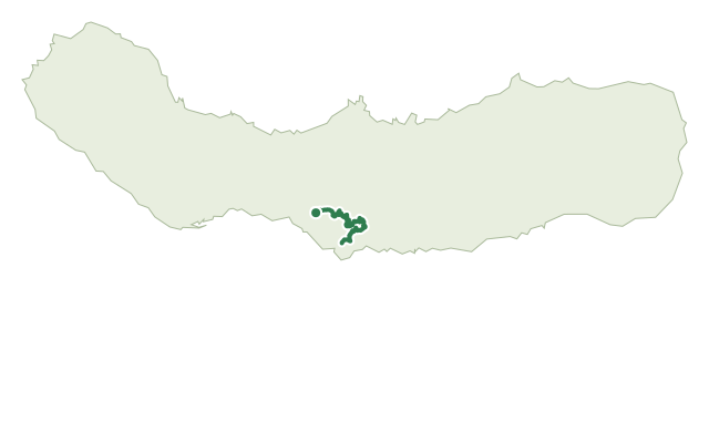
This moderate, full-day trail follows the old roads once used by watermen to channel water to the parish of Lagoa, crossing old bridges, aqueducts, clay pipelines, levadas and several tunnels along the way. Bring a torch for the tunnels and make sure you're properly equipped before setting out; the route shares stretches with other trails, so watch the signposted marks carefully.
It starts near Casa da Água - Trail Point, an old milk depot now a help centre for hikers, and heads to Remédios past the chapel of the same name, perched on a high point with views over the south coast. Further on, several tunnels lead to Janela do Inferno, a spring-rich vertical wall where newts can sometimes be seen at different stages of their life cycle.
Past a fork where PRC37 SMI continues toward Remédios, the trail heads for Água de Pau, passing the viewpoint of Pico do Raposo, old bridges and a fountain, through the water-rich south slope of Fogo that once supplied Lagoa's potable water network. It crosses the Pedras Brancas climbing wall again near the PR41 SMI junction before ending in the centre of Água de Pau; at about 15.1 km and 5 hours, with around 800 m of climbing and 940 m of descent, this is the longest and most demanding of the Rota da Água trails.
Elevation · from the official GPX
Up and down the trail
Plan your walk · MET Norway & IPMA
When to go
Pick a start time. We forecast where you'll be each hour — 107 m at the lowest point, 496 m at the top.
Official facts, our words
What to know
Trail facts
Difficulty Moderate- Length
- 15.1 km
- Duration
- 5 hr
- Elevation gain
- 797 m
- Route
- Linear
- Highest point
- 496 m
- Steepest descent
- 32% at km 14.0
- Start
- Casa da Água - Trail Point, Remédios
- Finish
- Água de Pau
- Permit
- Not required
- Trail code
- PR42SMI
Route and facts © Azores trails network (visitazores.com)