Trails · Moderate
Rota da Água
A steep out-and-back climb tracing Angra's water supply from an old mill ruin to a panoramic viewpoint on Serra do Morião.
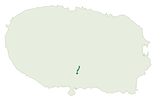
This route in the Nasce Água area, on the edge of Angra do Heroísmo, is built entirely around water: it starts near the ruins of five of the more than forty watermills that once worked the Ribeira dos Moinhos channel, and climbs the southern slope of Serra do Morião, part of the rim of the Caldeira de Guilherme Moniz.
Further up, in a restricted-access area, the route follows how rain falling inside the caldera becomes groundwater on the outer slope, captured, treated and piped to the city. Near the Mãe-de-Água spring sits one of three mini-hydroelectric plants in Angra, and midway up the slope a regulating tank collects water from the Furna d'Água and Cabrito springs. The route also passes the Cruzeiro da Serra da Costaneira monument before reaching the top of Serra do Morião, with wide views over Angra, Monte Brasil and the south coast; the way back follows the same path, with one short detour partway down.
It's a medium route of about 4.2 km, climbing roughly 350 m up the slope and the same back down; the surface is prone to becoming slick, so take extra care and wear suitable footwear, especially after rain.
Elevation · from the official GPX
Up and down the trail
Plan your walk · MET Norway & IPMA
When to go
Pick a start time. We forecast where you'll be each hour — 207 m at the lowest point, 552 m at the top.
Official facts, our words
What to know
Trail facts
Difficulty Moderate- Length
- 4.2 km
- Elevation gain
- 350 m
- Route
- Circular
- Highest point
- 552 m
- Steepest descent
- 40% at km 2.2
- Start
- Ribeira dos Moinhos
- Finish
- Ribeira dos Moinhos
- Permit
- Not required
- Trail code
- PRC12TER
Route and facts © Azores trails network (visitazores.com)