Trails · Easy
Vinhas da Criação Velha
An easy coastal walk through Pico's UNESCO-listed vineyard landscape, past tide wells, a historic windmill and an old wine-barrel ramp.
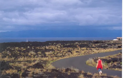
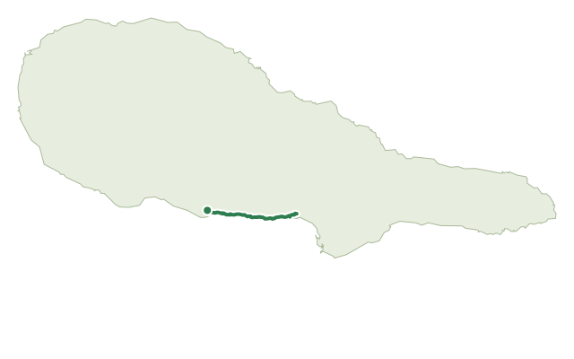
The walk follows the coast between Porto do Calhau and Porto da Areia Larga through the Protected Landscape for Vine Culture, a UNESCO World Heritage site, past walled vineyard plots still worked much as they always were.
Along the way you pass two tide wells — stone cisterns that once supplied brackish water to houses and vines — the picnic area at Porto do Pocinho, the bathing spot at Laja das Rosas, and the rebuilt Moinho do Frade windmill; near the end, look out for a well-preserved rola-pipas, the carved ramp once used to slide wine barrels down to waiting boats.
It's an easy, mostly flat 7 km walk of about 2 hours, with under 80 m of climbing overall — a good trail for taking your time over the vineyard details rather than rushing the distance. Visitors are asked not to pick fruit from the vines along the way.
Elevation · from the official GPX
Up and down the trail
Plan your walk · MET Norway & IPMA
When to go
Pick a start time. We forecast where you'll be each hour — 2 m at the lowest point, 54 m at the top.
Official facts, our words
What to know
Trail facts
Difficulty Easy- Length
- 7 km
- Duration
- 2 hr
- Elevation gain
- 78 m
- Route
- Linear
- Highest point
- 54 m
- Steepest climb
- 10% at km 1.1
- Start
- Porto do Calhau
- Finish
- Porto da Areia Larga
- Permit
- Not required
- Trail code
- PR05PIC
Route and facts © Azores trails network (visitazores.com)